Future Maps
Future Maps, Jennifer Justice, 2021. Laser cut Baltic birch and acrylic, 1.5" x 24" x 14.5." Detail.
Future Maps Image Description:
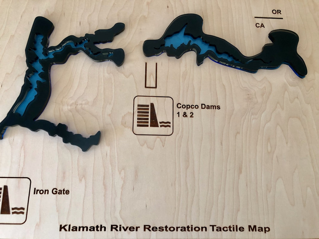
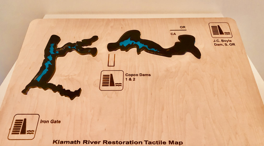
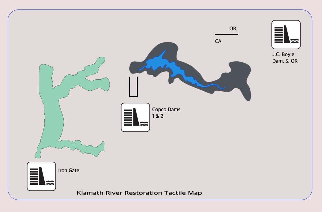
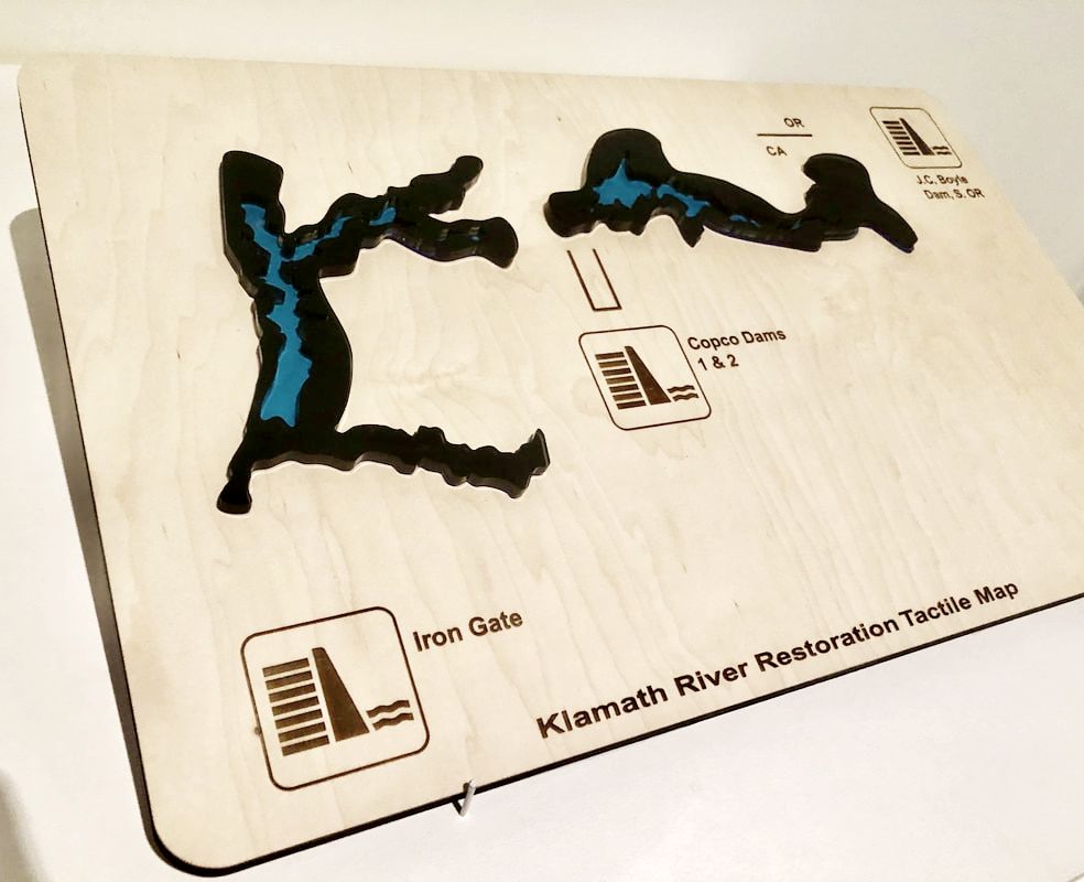
A minimalist laser cut tactile map displaying projected water levels for the Klamath River Basin dam removal project: a smooth, rectangular birch wood map base with high-gloss ultramarine blue and dark gray acrylic water levels. The blue riverbed, representing current water levels, is recessed within the larger gray waterways, which represents projected fill areas once the dams have been removed. The names of the dams are etched into the wood along with dam icons and arrows pointing go their current locations. From southwest to northeast these are Iron Gate, Copco Dam 1 and 2, and JC Boyle Dam (OR). A horizontal line segment at upper right illustrates the CA-OR state line. The segments of the Klamath River depicted in topographical acrylic map levels meet at the confluence of the two Copco Dam sites. The waterway segments have many tributaries snaking out from the river itself in all directions like capillaries or veins, but I chose to dramatically simplify this network for this first map project. The bottom text reads, “Klamath River Restoration Project.”
A minimalist laser cut tactile map displaying projected water levels for the Klamath River Basin dam removal project: a smooth, rectangular birch wood map base with high-gloss ultramarine blue and dark gray acrylic water levels. The blue riverbed, representing current water levels, is recessed within the larger gray waterways, which represents projected fill areas once the dams have been removed. The names of the dams are etched into the wood along with dam icons and arrows pointing go their current locations. From southwest to northeast these are Iron Gate, Copco Dam 1 and 2, and JC Boyle Dam (OR). A horizontal line segment at upper right illustrates the CA-OR state line. The segments of the Klamath River depicted in topographical acrylic map levels meet at the confluence of the two Copco Dam sites. The waterway segments have many tributaries snaking out from the river itself in all directions like capillaries or veins, but I chose to dramatically simplify this network for this first map project. The bottom text reads, “Klamath River Restoration Project.”
Future Maps, Jennifer Justice, 2021. Laser cut Baltic birch, acrylic, 1.5" x 24" x 14.5."
About the Project
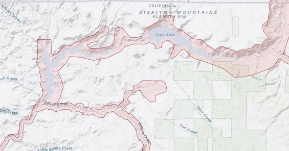
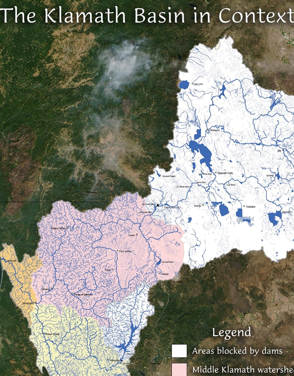
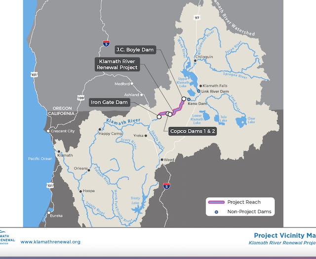
When I was invited to make new work for an exhibition at the Palo Alto Art Center, I knew I wanted to prototype a tactile map that would illustrate an effect of climate change on Northern California, where I currently live. The Klamath Basin Watershed spans 9.4 million acres across CA and southern Oregon. The removal of three mid-20th century dams in Siskiyou County and one in Klamath County, Oregon, is the largest ecological undertaking of its kind in the United States. The long term goal of the project is to improve the ecological health of the vast watershed and salmon fisheries maintained by the Yurok Nation and others to the southwest in Trinity and Humboldt Counties. The Yurok people generously made the LIDAR map data part of the public domain, so anyone can watch the waterways’ progress in the years and decades to come. Repurposing open-source mapping tools allows me and other artists to participate in the citizen-cartography that Californians now rely on to monitor conditions during wild fire season.
I was excited by the challenge of creating a minimalist tactile map from a complex store of map data. It’s also important to me to center and promote the native land stewardship initiatives underway throughout the region.
Future Maps, Jennifer Justice, 2021. Baltic birch, acrylic, 1.5" x 24" x 14.5."
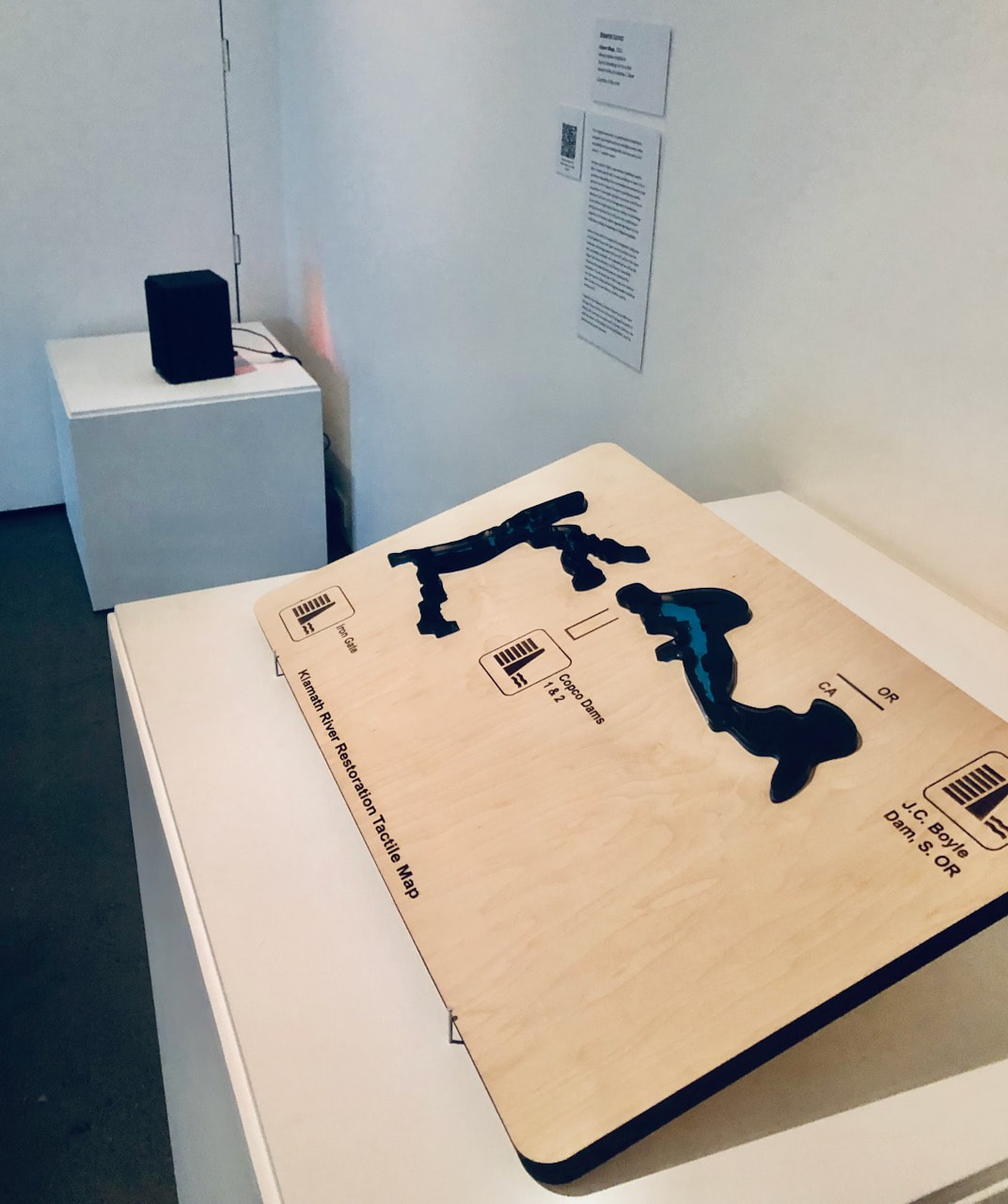
Future Maps, 2021. Installation, Palo Alto Art Center.